Unlock Your Hydrocarbon Potential with Us
We provide expert subsurface studies and consulting services for the upstream energy sector, optimizing exploration, drilling, and production strategies across the entire asset life cycle. We offer detailed studies and consulting for the upstream energy sector, improving exploration, drilling, and production throughout the entire life of the asset. From in-depth geophysical and Our data-driven approach supports informed decision-making, helping clients navigate complex challenges and achieve sustainable energy solutions.
Reveal What Others Overlooked:
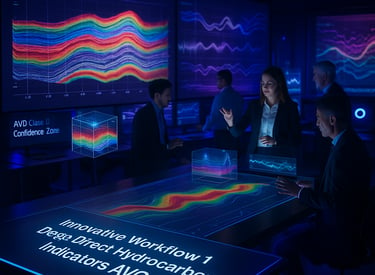
De-risk Prospects with DDAV Workflow
Empowering Energy Exploration and Production
At CoreFlow, we specialize in delivering comprehensive subsurface studies and consulting services tailored to the upstream energy sector. By integrating cutting-edge geophysical, geological, and engineering expertise, we provide data-driven solutions that enhance reservoir understanding, optimize exploration and production workflows, and improve decision-making. From prospect evaluation and reservoir characterization to drilling optimization and full-field development planning, we support clients throughout the entire asset life cycle, ensuring efficiency, cost-effectiveness, and maximized resource recovery.


Innovative Subsurface Solutions - DDAV technology
Precision in Energy Consulting - Drilling Processes
At CoreFlow, we conduct in-depth drilling process studies to optimize well planning, execution, and performance across diverse geological settings. We successfully supported clients by integrating advanced subsurface analysis with drilling engineering solutions to mitigate operational risks and enhance efficiency. Our studies encompassed well trajectory design, pore pressure prediction, geomechanical modeling, and drilling fluid optimization, ensuring safe and cost-effective drilling campaigns. By leveraging cutting-edge data analytics and real-time monitoring, we provided actionable insights that minimized non-productive time (NPT) and improved overall drilling success. Our tailored approach helps operators navigate complex offshore and deepwater environments, ensuring seamless well delivery and maximizing hydrocarbon recovery.
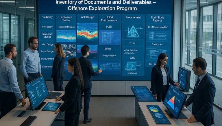
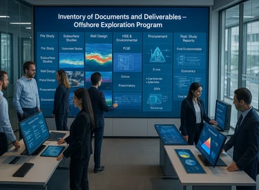
Our Services
Comprehensive solutions for upstream energy sector optimizing exploration and production workflows.
2. Drilling Planning & Well Execution Strategy
Our Drilling Planning and Execution Strategy service is focused on delivering cost-effective, technically robust well planning solutions that align with Planet One’s exploration and development strategy. We provide conceptual and detailed well designs, integrating pore pressure and geomechanical modeling, casing and tubing selection, and real-time drilling risk assessment. Our expertise ensures a safe, efficient, and compliant execution plan, utilizing state-of-the-art technologies such as dynamic modeling, MPD planning, and deepwater drilling optimization. Whether in Ghana, the UAE, or other offshore environments, we offer a flexible, scalable drilling roadmap that can be tailored to support single-well exploration or full-field development strategies.

1. Subsurface Evaluation & Integrated Geological and Geophysical (G&G) Studies
Our Subsurface Evaluation and G&G Studies service provides a comprehensive assessment of hydrocarbon potential using advanced seismic interpretation, rock physics modeling, and cutting-edge machine learning workflows. We specialize in AVO analysis, seismic inversion, and direct hydrocarbon indicator (DHI) identification, enabling precise de-risking of exploration targets. Our expertise spans structural and stratigraphic interpretation, reservoir characterization, and prospect maturation, ensuring that clients receive a high-confidence assessment of exploration opportunities. Our studies are designed to support strategic decision-making, providing an optimized path for future drilling campaigns while mitigating subsurface uncertainties.
Uncovering Hidden Value with DDAV Workflow
What makes the DDAV workflow unique compared to traditional interpretation methods?
The DDAV workflow is designed to go beyond conventional amplitude interpretation, using advanced AVO Class II/IIp analysis. It enables us to detect subtle hydrocarbon indicators in areas that traditional workflows often dismiss as non-viable.How does DDAV improve exploration success rates?
By identifying overlooked AVO Class II and IIp anomalies, DDAV significantly reduces exploration risks and enhances drilling confidence. This results in higher exploration success rates and better ROI for operators and investors.What level of data is required for DDAV analysis?
DDAV leverages existing multi-client or proprietary seismic data, meaning there’s no need for additional costly acquisition. Our approach extracts more value from your current datasets, accelerating project timelines and maximizing returns.How has DDAV been proven in the field?
Our methodology was successfully applied to some prospects in the offshore Nile Delta, leading to a major gas discovery for low amplitude prospect. This case demonstrates how DDAV can uncover high-potential prospects that traditional methods overlook.Can this workflow be applied outside the Nile Delta or East Mediterranean?
Absolutely. The principles behind the workflow — seismic attribute optimization, AVO modeling — are play-agnostic. While proven in the East Mediterranean, it is equally valuable in West African deepwater, Gulf of Mexico, and other frontier basins where subtle anomalies are often missed.How does DDAV contribute to investor confidence?
By providing a transparent, risk-assessed, and prioritized prospect portfolio, DDAV gives decision-makers a reliable foundation for exploration investments. This clarity strengthens investor confidence and accelerates project approvals.What industries and teams benefit from DDAV?
The DDAV workflow is designed for exploration teams, geoscientists, investors, and decision-makers in oil and gas companies. It supports cross-disciplinary collaboration, ensuring geophysical insights translate into economic value.What AVO classes are detectable by traditional workflows versus DDAV?
Traditional workflows primarily identify strong amplitude anomalies, such as AVO Class I and III. DDAV, however, is optimized for subtle, low-amplitude AVO Class II and IIp anomalies—hidden opportunities often missed by conventional interpretation.What is the exploration and economic impact of DDAV?
DDAV identifies overlooked, lower-risk prospects supported by direct hydrocarbon indicators (DHI), reducing dry well risk and optimizing exploration budgets. By uncovering these hidden resources, operators can unlock significant economic value.
Project Highlights
Shallow Exploration - EGYPT
Directed a 3D seismic interpretation initiative utilizing DDAV technology, culminating in the identification of concealed prospects within a clearly delineated play.
Deepwater Exploration – EGYPT
Led a 3D seismic interpretation campaign in an ultra-deepwater block, integrating seismic attributes with well and production data.
Uncovered new structural leads, significantly de-risking the acreage and providing valuable insights for further exploration.
Carbonate Reservoir Characterization – Middle East
Applied advanced seismic attribute analysis and inversion to delineate complex carbonate facies.
Enhanced reservoir models and drilling plans by accurately predicting porosity distribution, resulting in optimized well placement.
Complex Clastic Reservoir Study – North Africa
Conducted multi-attribute analysis (coherence, curvature, ant-tracking) to identify faults, fractures, and stratigraphic traps.
Improved field development strategies by refining reservoir architecture and enhancing understanding of sand-body connectivity.
Quantitative Interpretation & Seismic Inversion
Utilized advanced inversion workflows to integrate seismic, geological, and petrophysical data.
Provided robust rock property estimates that reduced exploration risk and led to more accurate volumetric assessments.
Real-Time Drilling Support & Geo-Hazard Mitigation
Provided on-the-fly seismic interpretation to adjust well trajectories and avoid potential drilling hazards.
Reduced non-productive time (NPT) and ensured safer drilling operations by anticipating unexpected overpressures and structural complexities.
Collaborative Field Development Planning
Worked with reservoir engineers, geologists, and petrophysicists to create integrated static reservoir models.
Accelerated decision-making through coordinated, multidisciplinary workflows, leading to timely field development plans.


Recent Achievements
Enhanced Exploration Accuracy
Challenge: A client operating in a remote deepwater block sought to reduce exploration risk in structurally complex settings.
Solution: Applied advanced 3D seismic interpretation and attribute analysis to identify high-potential leads.
Outcome: Improved drilling success rate, saving the client significant costs on dry-hole drilling.
Optimized Well Placement
Challenge: A Middle Eastern operator needed more accurate reservoir characterization in a giant carbonate field to plan new wells.
Solution: Integrated seismic inversion with petrophysical and production data to better delineate porosity trends and fracture corridors.
Outcome: Achieved more efficient well placement, reducing drilling time and maximizing reservoir contact.
Real-Time Drilling Support
Challenge: An onshore operator struggled with unexpected pressure anomalies and drilling hazards.
Solution: Provided real-time seismic interpretation and look-ahead services, combining seismic data with drilling parameters to predict potential hazards.
Outcome: Minimized non-productive time (NPT) and enhanced operational safety by avoiding overpressured zones.
Fractured Reservoir Development
Challenge: A North African client needed to better understand the fracture network in a tight sandstone reservoir.
Solution: Used curvature, coherence, and ant-tracking seismic attributes to map fracture corridors and integrate them into the static reservoir model.
Outcome: Improved stimulation strategies led to increased production rates and optimized completion design.
Integrated Field Development Planning
Challenge: An international operator required a unified approach to field development, integrating seismic, geological, and engineering data.
Solution: Deployed a multidisciplinary workflow that incorporated seismic attributes, reservoir modeling, and dynamic simulation.
Outcome: Accelerated decision-making, resulting in a robust field development plan and timely project execution.


Client Success
We empower our clients through tailored consulting services, optimizing their exploration and production workflows to achieve significant operational improvements and investment de-risking in hydrocarbon asset management.

Exceptional services! Their expertise in reservoir characterization greatly improved our project outcomes and decision-making.

Innovative solutions that transformed our exploration approach. A trusted partner in optimizing our production workflows.

★★★★★
★★★★★
Consulting
Expert subsurface studies and diriiling processes for energy sector optimization.
Innovation
Efficiency
© 2025. All rights reserved.